Snow update
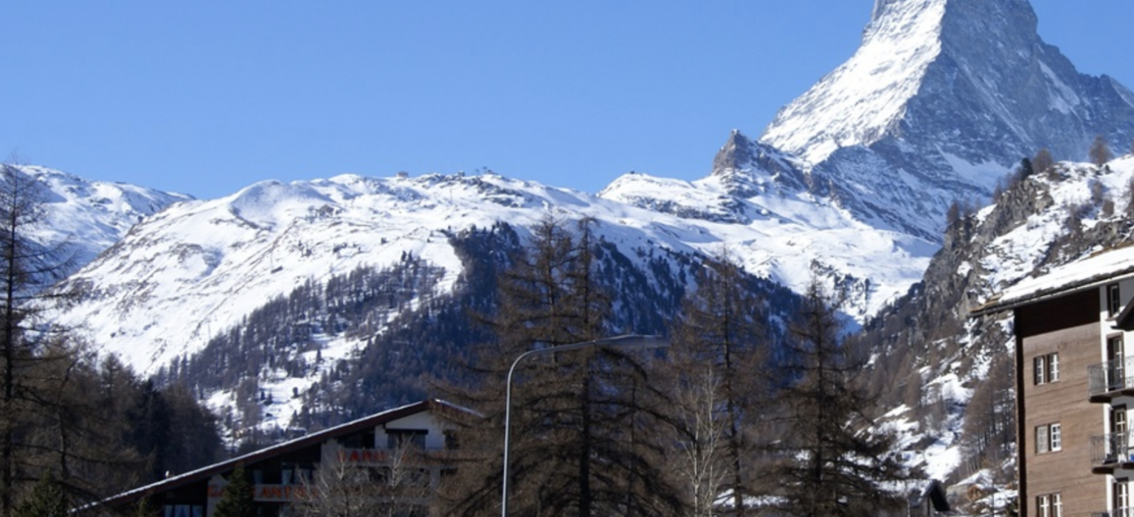
Light snow gives the Alps a fresh covering and conditions are tip top across the pond too. Here’s the latest snow report from the Ski Club.
OVERVIEW
The vast majority of Alpine resorts saw light snow this week, continuing yesterday with many resorts expecting only small accumulations. The exception is the Italian Piedmont and resorts around the Matterhorn, which are expecting heavy snow over the weekend. Expect heavy cloud cover to limit visibility almost everywhere other than at the highest altitudes. The Pyrenees continues to see far heavier snowfall, especially on the French side though also across Andorra, where powder conditions could be found on Wednesday and Thursday due to recent heavy snowfall.
Great conditions are on offer across the vast majority of North America. While Canada is in the grips of a cold spell, a superbly snow filled February has meant pistes are in excellent conditions. While somewhat delayed, winter has truly arrived over the Rockies in the USA, with Utah in particular but Colorado also seeing an exceptionally good past 10 days, improving conditions across the broad. Unfortunately rain fell across the east coast in both the USA and Canada, leading to icy slopes with the potential for more to come over the weekend as the weather continues to fluctuate.
SNOW ALERT
Based on current weather forecasts for the next 9 days, the top three resorts for expected snowfall are:
Zermatt, Switzerland (pictured above) 245cm
Macugnaga, Italy, 165cm
Cervinia, Japan, 155cm
AUSTRIA
This week saw light cloud and snow cover over much of Austria, predominantly on the 20th and 21st, and falling most heavily in the north and east of the country. Temperatures have remained relatively consistent through the week, generally sitting between -5C and -10C moving into Thursday. Thick, low cloud reducing visibility persisted across many resorts, as did more newly recorded snowfall across resorts such as Bad Kleinkirchheim (50/130cm) and Obertauern (200/250cm) seeing 10cm, though the majority of resorts seeing snowfall were only reporting lighter dustings. This cloud is significantly impacting visibility across much of the region at all altitudes. The only resorts other than the most easterly resorts seeing sunshine are those glaciers with skiing options above the clouds.
The current weather pattern looks likely to continue over the coming few days with clouds remaining in place over the coming days until at least the early part of the next week. Temperatures look to fluctuate slightly, with Sunday delivering the heaviest snow followed by a bitterly cold Monday next week.
FRANCE
Largely, it has been a combination of sunny and cloudy weather over last few days in our French Alp featured resorts. Val Thorens (244cm/290cm) recorded 10cm of fresh snowfall on Wednesday, which will have refreshed the slope quality. Both Tignes (232cm/360cm) and Chamonix (100cm/405cm) recorded 10cm of fresh snow on Tuesday. It’s been a different story in the French Pyrenees, with a huge storm covering the area on Wednesday. Bareges/La Mongie (130cm/170cm) recorded a big snowfall of 50cm, which meant powder like conditions continuing into Thursday. The largest snowfall was in Cauterets (150cm/350cm) with 70cm. Both resorts are enjoying sunny conditions to provide great views. More snow is forecast from today. The three largest fresh snowfall predictions will be in Bonneval sur Arc (260cm/385cm), Isola 2000 (115cm/205cm) and Val d’Isere (230cm/360cm) which have forecast 46cm, 36cm and 31cm respectively.
SWITZERLAND
Thursday was fairly cloudy across our featured Swiss resorts. Visibility was also an issue in some areas, and light snow was expected to fall during the course of the day.
Skiing conditions in resorts such as Davos/Klosters (126/255cm) were improved on Wednesday thanks to a light smattering of around 6cm of fresh snow. On the Austrian/Swiss border there is very good skiing at Samnaun (100/170cm), where 20cm of new snow was accumulated on the same date. For those that managed to get up early in the morning there were likely to still be some fresh tracks to be found up high around the Pardatschgrat.
Lower slopes at resorts such as Grindelwald in the Jungfrau (1/23cm), or in the 4 Vallees at Nendaz 20/375cm) were looking hard packed and maybe in need of freshening up, but skiing on the upper slopes still remains in great nick.
Of all our featured resorts, Zermatt (150/350cm) was expecting the most snow yesterday, with roughly 27cm predicted to fall, whilst for most other resorts around 5cm was forecast. The coming weekend is likely to yield much of the same weather, and currently next Wednesday looks like the next window for clear skies.
ITALY
None of our featured Italian resorts have reported snow over the week thus far, with the most recent snowfall being the tail end of last week for most. Clouds have now moved in across almost the entire region however bringing poor visibility; only a handful of resorts in the North East were cloud free, such as Courmayeur (145/250cm). Snow had started falling in some resorts by mid-morning of Thursday and was expected to do so elsewhere over the course of the day. This will hopefully top up some slopes, and in particular refresh some increasingly heavily tracked off piste skiing options.
Forecasts indicating light to moderate snowfall on Thursday, becoming heaviest today. The Piedmont region looks on track to see the largest accumulations, including current predictions of up to 50cm over Cervinia (70/380cm), with other resorts in the Aosta Valley also in line for plenty of new snow. Moderate accumulations are expected for the majority of the rest of our featured resorts well into next week.
ANDORRA
More snow fell across Andorra this week, including 40cm recorded on Wednesday in the Grandvalira area. Thursday saw a more modest 8cm recorded, though by midday the skies had cleared into an increasingly sunny day. Lift operations are back up to full capacity, beneficial given the increased queues due to the recent snow. The change of weather looks to mark the start of a sunny weekend, looking to stay in place at least until Monday.
SCANDINAVIA
In our Finnish featured resorts it has been a mixture of sunny and cloudy weather, with more of the same being forecast for the rest of the week. There are great skiing conditions in Ruka (81cm) in which they have full lift operation, complimented by bright weather. In Norway, there is very similar weather to Finland, however, two of our featured resorts recorded a light dusting of snow, with Lillehammer (60cm/219cm) and Voss (90cm/270cm) receiving 1cm and 6cm respectively. In Sweden, Are (93cm) and Salen (129cm) are experiencing completely different weather conditions. In Are it’s overcast, with the chance of light snowfall, however in Salen there is great skiing conditions complimented by blue skies and sunny weather. The next snowfall is expected on Sunday with Are forecasting 13cm and Salen forecasting 4cm of fresh snow.
GERMANY
The majority of our featured German resorts have seen light dustings of snow over the past few days, primarily on Wednesday, though only a few cm. The clouds have lingered however, with the possibility of more snow falling on Thursday, as it had in Berchtesgaden (15/160cm) by mid-morning. In the meantime, the snow has kept the slopes relatively fresh, especially on the upper slopes. However the cloud is continuing to limit visibility somewhat. Expect little change in conditions over the coming days, though temperatures do look to drop significantly from Sunday onwards into early next week.
EASTERN EUROPE
Snow is expected to start falling in our featured Bulgarian resorts. Bankso (40cm/210cm) is forecast 27cm by the evening of Sunday, whilst Borovets (130cm/170cm) and Pamporovo (70cm/120cm) are expecting 10cm.
Jasna (30cm/50cm) enjoyed a dusting of fresh snow on Wednesday with 5cm recorded. At Kranjska Gora (90cm/110cm) it was snowing lightly yesterday with around 5cm more expected today.
SCOTLAND
It was a windy day across Scotland on Thursday so much so that Cairngorm (30/75cm) was on a wind hold and assessing conditions as the day went on. Pistes are currently very hard at the moment, especially at Glencoe (160/26cm) where ‘Flypaper’ was closed due to icy conditions. That said, conditions are still good and certainly better than they have been in recent seasons. Generally, the snowpacks are holding up well, and some fair weather this weekend is likely to allow for nice skiing on the groomed trails
USA
Conditions across much of North America continue to improve, in particular across Utah and Colorado. Snowbird (218cm) and Alta (203cm) are standouts, having seen more than 160cm in the past 7 days. These fantastic conditions took set to continue, with continuing cold weather preserving the snow as well as lighter snowfalls to keep it fresh. A delayed start to the season has really now changed into a great high season in the Rockies.
California has also seen a slight uptick in conditions, with Mammoth (97/213cm) seeing snow over the past 3 days, with forecasts showing more expected yesterday. Further up the west coast, Timberline (292cm) also had a great powder day on Wednesday with 41cm coming down. This is set to be exceeded however by up to 70cm on Sunday if forecasts hold true.
The exception to this is our featured New England resorts, which saw mild weather deliver rain on Tuesday. This led to some reduced mountain access, as well as increasingly hard and icy slopes now that a new cold front has moved in. Unfortunately this changeable weather looks to continue over the coming few days, with the potential for more rain to come
CANADA
Little had changed in terms of the skiing conditions in Canada this week, with minimal new snow over the past few days, with predominantly sunny skies and bitterly cold temperatures.
These mercifully rose, even if only slightly by Thursday, though the cold conditions are producing some very grippy snow. Thursday looks to be the last day of clear skies, with new snow arriving from Thursday evening and today across Alberta and British Columbia. No substantial snowfall is forecast imminently, though it will get gradually heavier over the course of the weekend.
Unfortunately mild temperatures resulted in rail falling in Quebec, impacting both Mont Sainte Anne (40/245cm) and Tremblant (60cm). Both slopes suffered, leading to grooming teams restricting lift and slope access to allow the trails to recover. Now that the temperatures have dropped once again, expect icy conditions on many slopes.
JAPAN
There continues to be a substantial disparity in the snowfall across Japanese resorts, with Niseko (255/510cm) and Rusutsu (312/337cm) on the northern island of Hokkido seeing substantially more than that recorded in Hakuba (130/430cm) on the more southerly island of Honshu. Niseko in particular has seen snow recorded on almost all of the last 10 days, with shows no sign of abating as we move towards the end of the month. This is not to say the conditions in Hakuba are in any way lacklustre, simply that the more northerly resorts are delivering some especially good skiing options.
Related News Stories:
Bev
Editor in chief Bev Fearis has been a travel journalist for 25 years. She started her career at Travel Weekly, where she became deputy news editor, before joining Business Traveller as deputy editor and launching the magazine’s website. She has also written travel features, news and expert comment for the Guardian, Observer, Times, Telegraph, Boundless and other consumer titles and was named one of the top 50 UK travel journalists by the Press Gazette.
 United Kingdom
 United States
 Asia Pacific


















Dozens fall ill in P&O Cruises ship outbreak
Turkish Airlines flight in emergency landing after pilot dies
Boy falls to death on cruise ship
Unexpected wave rocks cruise ship
Storm Lilian travel chaos as bank holiday flights cancelled